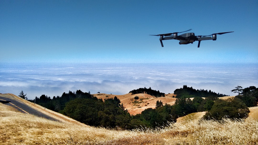
 Photo from Unsplash
Originally Posted On: https://drdrone.ca/blogs/drone-news-drone-help-blog/dji-mavic-3-enterprise-comparison
Introducing the DJI Mavic 3 Enterprise Lineup–a trio of cutting-edge drones designed to meet a variety of professional needs. The lineup includes the Mavic 3 Enterprise, Mavic 3 Thermal, and Mavic 3 Multispectral drones, each equipped with unique camera capabilities for specific applications. With advanced features like DJI
O3 Enterprise transmission, terrain-following technology, and an optional RTK module, these drones deliver unprecedented data accuracy and efficiency.
The Mavic 3 Enterprise is ideal for mapping and surveying vast terrains, featuring a powerful sensor with a mechanical shutter that ensures high-quality imagery and efficient interval shooting. The DJI Mavic 3 Thermal excels in inspections with its thermal camera, supporting temperature measurement, high-temperature alerts, and isotherms. The Mavic 3 Multispectral integrates five imaging sensors for comprehensive mapping, making it perfect for monitoring crop health and performing environmental assessments. Read on to find out how the three drones compare and which one might be right for you.
Mavic 3EMavic 3TMavic 3M
Starting Price
CAD $4,489.00 | US $3,628.00
CAD $6,879.00 | US $5,489.00
CAD $5,945.00 | US $4,618.00
Dimensions
(LxWxH)
Folded (without propellers): 221×96.3×90.3 mm
Unfolded (without propellers): 347.5×283×107.7 mm
Folded (without propellers): 221×96.3×90.3 mm
Unfolded (without propellers): 347.5×283×107.7 mm
Folded (without propellers): 223×96.3×122.2 mm
Unfolded (without propellers): 347.5×283×139.6 mm
Weight
915 g
920 g
951 g
Image Sensor size
4/3″ and 1/2″ Sensor Dual Camera
Dual 1/2″ CMOS and 640×512 Thermal Imager
Quad 1/2.8-inch CMOS Multispectral and 4/3 CMOS
Max Photo Resolution
20 MP
48 MP (Visual Only)
20 MP
Video Transmission
O3 Enterprsie 15km 1080p@30fps
O3 Enterprsie 15km 1080p@30fps
O3 Enterprsie 15km 1080p@30fps
Vision System
Omnidirectional
Omnidirectional
Omnidirectional
Max Flight Speed
68.4 kph (S-Mode)
68.4 kph (S-Mode)
68.4 kph (S-Mode)
Max Flight Time
45 Minutes
45 Minutes
43 Minutes
Suitable Applications
Surveying and Mapping (Visual Photogrammetry)
Inspections, Search and Rescue, Public Safety
Agricultural and Natural Resource Monitoring
Powerful Cameras, Precise Applications
DJI Mavic 3 Enterprise
The DJI Mavic 3E is the perfect tool for mapping and surveying large areas of land. It boasts a powerful 20MP, 4/3 CMOS sensor with a wide-angle lens that incorporates a mechanical shutter. This innovative design effectively reduces motion blur and enables rapid interval shooting at an impressive interval of 0.7 seconds. What sets the DJI Mavic 3E apart is its exceptional feature set, which allows for highly effective mapping and surveying missions, all without the need for Ground Control Points.
Wide Camera:
4/3 CMOS, 20MP, Mechanical Shutter
Tele Camera:
Equivalent Focal Length: 162mm, 12MP, 56× Hybrid Zoom
The Mavic 3E also demonstrates remarkable improvements in low-light performance. Thanks to its large 3.3 mm pixels on the wide camera, coupled with an intelligent low-light mode, users can expect a significant increase in their ability to capture clear and detailed footage in challenging lighting conditions. The Mavic 3E is also equipped with a 12MP zoom camera that delivers outstanding focus capabilities. With a maximum hybrid zoom of 56x, users can now closely inspect crucial details even from a considerable distance, making it an invaluable tool for mapping and surveying.
DJI Mavic 3 Thermal
With a resolution of 640 x 512, the thermal camera integrated into the DJI Mavic 3T offers a range of essential features to enhance your inspection process. This advanced camera supports point and area temperature measurement, high-temperature alerts, and color palettes, along with isotherms that aid in precisely identifying your targets and making swift decisions.
Wide Camera:
Equivalent Focal Length: 24mm, 48MP
Zoom Camera:
Equivalent Focal Length: 162mm, 12MP, 56× Hybrid Zoom
Thermal Imaging Unit:
DFOV: 61°, Equivalent Focal Length: 40mm, Resolution 640 × 512
The Mavic 3T takes it a step further by supporting 28x continuous side-by-side zoom, enabling effortless comparisons between different thermal perspectives. Both the Mavic 3E and Mavic 3T share a 12MP Zoom Camera, providing an impressive maximum hybrid zoom of up to 56x. This powerful feature allows you to effectively observe and analyze critical details from considerable distances, making the Mavic 3 Thermal indispensable during the inspection process.
DJI Mavic 3 Multispectral
The DJI Mavic 3M uses a remarkably integrated imaging system that cleverly combines five distinct imaging sensors into a single, foldable package. At its core lies a main RGB camera, empowered by a 20MP 4/3 CMOS sensor similar to the one featured in the DJI Mavic 3E. Enhancing its capabilities further, the drone incorporates multispectral imaging facilitated by four individual 5MP sensors, each adept at capturing specific types of imagery:
- Near-infrared (NIR) – 860 nm ± 26 nm
- Red edge (RE) – 730 nm ± 16 nm
- Red (R) – 650 nm ± 16 nm
- Green (G) – 560 nm ± 16 nm
The multispectral camera is designed to map orchards, monitor plant health, and perform field reconnaissance with ease. Thanks to the 4/3 CMOS and ample individual pixel size, the RGB camera excels in both high dynamic range and exceptional low-light performance. The camera also features a mechanical shutter capable of capturing images at a rapid 1/2000 sec shutter speed, and it effortlessly performs high-speed burst shooting with an impressive 0.7-second interval.
RTK Positioning
The optional RTK Module allows you to achieve centimeter-level precision during your flight with the Mavic 3E, 3T, and 3M. You can use it to precisely pinpoint the imaging center, flight control, camera, and RTK module sync locations with unparalleled speed, accomplishing this task in a matter of microseconds. The DJI Mavic Enterprise Lineup also includes support for network RTK, customized network RTK services, as well as a D-RTK 2 Mobile Station that communicates with 4G, OcuSync, WiFi, and LAN.
Use Cases
Mavic 3 Enterprise
The DJI Mavic 3E drone offers a wide range of use cases thanks to its advanced features. The precise GPS and imaging features enable it to create detailed maps and perform accurate surveys for construction, agriculture, mining, and more. Its high-resolution cameras and stable flight capabilities make it suitable for professional photography and filmmaking applications. It can also be used to perform surveillance in industries such as security or public safety.
Mavic 3 Thermal
The Mavic 3T contains advanced thermal imaging capabilities that make it an excellent fit for aerial inspections of infrastructure, buildings, power lines, and pipelines. This will thereby reduce the need for manual inspections and aid in inspecting hard-to-reach or dangerous locations. It can also assist in search and rescue missions, helping to locate missing persons or stranded individuals in challenging terrains or disaster-stricken areas. The drone can aid firefighting efforts by detecting hotspots and assessing the spread of fires.
Mavic 3 Multispectral
The DJI Mavic 3M contains multispectral imaging sensors that can be used to monitor crop health, identify problem areas, and optimize irrigation and fertilization in precision agriculture applications. It can be used to monitor and assess environmental conditions, such as air quality, water pollution, and wildlife tracking, providing valuable data for environmental research and conservation efforts. The drone’s multispectral sensors can even be used for remote sensing applications, including monitoring vegetation health, land use analysis, and geological surveys.
Workflow
Mavic 3 Enterprise
The DJI Mavic 3 Enterprise features a full software suite that includes DJI Pilot 2, a redesigned flight interface tailored for increased flight safety and pilot productivity. With a single tap, users gain convenient access to drone and payload controls. The interface ensures a seamless user experience, presenting flight information and navigational data in a clear manner, while also supporting various route types for enhanced flexibility.
You can effortlessly manage your drone fleet’s operations with DJI Flighthub 2, a comprehensive cloud-based solution. This all-in-one platform supports real-time annotations and cloud mapping, fostering seamless ground-to-cloud synergy. Utilize its mission management and route planning capabilities to effectively handle inspection activities and optimize operational efficiency.
For comprehensive mapping tasks, the Mavic 3 Enterprise is fully compatible with DJI Terra, a robust mapping software that covers every aspect of the job. From mission planning to the processing of 2D and 3D models, DJI Terra offers a complete and efficient solution for mapping and surveying tasks.
Mavic 3 thermal
In addition to the above tools, the DJI Thermal Analysis Tool (DTAT) 3.0 is a powerful tool that enables users to analyze, annotate, and process photos captured by the M3T camera. It excels in detecting temperature anomalies during inspections, providing valuable insights and aiding in critical decision-making.
Mavic 3 Multispectral
The DJI Mavic 3M introduces innovative terrain-following technology, allowing seamless airborne surveys of orchards, even on steep terrains. Using DJI Terra or DJI SmartFarm Platform, users can reconstruct high-resolution orchard maps, automatically count trees, distinguish them from other objects or barriers, and create precise three-dimensional operating paths for agricultural drones.
For optimized crop management, the Mavic 3M captures multi-spectral images of crops, facilitating rice fertilization, cotton growth management, and potato foliar fertilizer application. By generating NDVI and other vegetation indices maps, DJI Terra or the DJI SmartFarm Platform enable the creation of prescription maps for variable-rate application, ultimately leading to cost reduction, increased yield, and environmental preservation.
The Mavic 3M also streamlines field reconnaissance. Field scout images are swiftly transmitted to the DJI SmartFarm Platform, which promptly identifies irregularities like emergence deficits, weed pressure, and crop lodging. Leveraging AI identification, intelligent analyses such as cotton seedling identification and real-time crop growth information sharing become accessible, empowering agronomic activity guidance and seamless management of vast farmland areas by a single individual.
With the Mavic 3M, environmental and natural resource surveys become easier than ever. From urban green spaces to forest distribution and water enrichment, these surveys can be conducted efficiently and effectively, providing valuable insights for environmental monitoring and conservation efforts.
Flight Time and Transmission Range
Mavic 3 Enterprise and Thermal
The Mavic 3E and Mavic 3T both yield 45-minute flight times, allowing you to survey up to 2 square km in a single trip. You can perform continuous, all-day operation with only four intelligent flight batteries. The drones use quad-antenna O3 Enterprise Transmission, allowing for more reliable connections in more challenging situations. With the O3 Enterprise transmission system, you can maintain a stable connection within a maximum transmission distance of up to 15 km.
Mavic 3 Multispectral
The Mavic 3M can fly for 43 minutes and cover a significant amount of ground. Like the M3E and M3T drones, the Mavic 3M uses an O3 image transmission system that incorporates two sending signals and four receiving signals with quad antennas. This allows the drone to achieve 15 km ultra-long transmission distances.
Obstacle Avoidance
All three drones come with omnidirectional obstacle avoidance for safe flying. You can adjust the braking distance and proximity warnings based on the needs of each individual flight. The drone uses advanced RTH to automatically determine the best path home, saving you time and effort while allowing you to fly worry-free. APAS 5.0 allows the drone to reroute around obstacles, keeping your drone safe no matter what.
With the DJI Mavic 3 Multispectral, you can use terrain-following aerial surveying to maintain accurate altitude above ground level with challenging terrain.
Modular Accessories
Mavic 3 Enterprise Series Loudspeaker
For search and rescue operations, there is a powerful loudspeaker accessory that can broadcast messages from the drone. This functionality includes support for text-to-speech, allowing automated announcements in real-time.
Additionally, it enables audio storage and looping, ensuring crucial messages can be delivered repeatedly, increasing the effectiveness of search and rescue missions and enhancing communication between the drone and personnel on the ground.
DJI Mavic 3 Battery Charging Hub
With the Mavic 3 Charging Hub, you can conveniently connect up to 3 batteries to charge them sequentially. This intelligent charging system prioritizes efficiency by charging the battery with the highest remaining capacity first. Once that battery is fully charged, the charging hub automatically moves on to the next battery with the next highest capacity. This sequential charging process ensures that you can quickly and easily get your Mavic 3 back in the air, making it a seamless and time-saving solution for managing multiple batteries during your flights.
D-RTK 2 High Precision GNSS Mobile Station
This cutting-edge high-precision receiver is capable of supporting all major global satellite navigation systems. It empowers users with real-time differential corrections, resulting in centimeter-level positioning data for unparalleled relative accuracy. The D-RTK 2 Mobile Station is fully compatible with GLONASS, GPS, Beidou, and GALILEO signals, offering comprehensive satellite support. Its seamless setup allows drones to access real-time differential data. It also features a built-in high-gain antenna, ensuring superior signal reception from a multitude of satellites, even in obstructed environments.
Equipped with OcuSync, WiFi, LAN, and 4G capabilities, it keeps users connected and well-informed throughout every mission. It is also designed to withstand demanding conditions, featuring an IP47 level ingress protection rating and a lightweight carbon fiber body. These features ensure exceptional durability while maintaining an ultra-portable form factor. Additionally, the built-in IMUs (Inertial Measurement Units) monitor movements and calibrate the tilt sensors, providing real-time alerts to users in case of any abnormalities during a mission, thus minimizing potential risks.
Internal Storage
While the drones themselves do not contain internal storage, they do allow users to insert a microSD card for data storage. Users can insert a microSD card into the designated slot to record and store photos, videos, and other data captured during flights. Using a microSD card makes it easy to transfer files to a computer or other devices while also swapping out cards during extended operations.
remote controller
All three drones come with the DJI RC Pro Enterprise, a portable remote control designed to enhance your drone operations. It features a 1.5-hour 65W quick charge capability, ensuring minimal downtime and prolonged usage in the field. Equipped with a built-in microphone, it enables excellent communication between the pilot and ground teams, facilitating seamless coordination during missions. The remote control is further enhanced by a 1,000-nit high brightness screen, ensuring clear visibility even in direct sunlight, providing an optimal flying experience.
Encryption and Data Safety
The Mavic 3 Enterprise, Thermal, and Multispectral drones all use local data encryption to ensure that data stored on the drone’s internal storage, memory card, or connected devices remains secure and protected from unauthorized access. During flight, data transmitted between the drone and the remote controller is encrypted to prevent interception and tampering. This ensures that telemetry and control data remain confidential and safe from potential threats.
The drones also include a privacy mode feature, which allows users to disconnect the drone from the internet, ensuring that sensitive flight data does not get transmitted to DJI or other external servers. Firmware updates are digitally signed by DJI to ensure their authenticity and integrity.
All three drones use an open developer ecosystem that allows you to connect the drones directly to third-party cloud systems. Using DJI Pilot 2’s built-in MQTT-based protocols in the DJI Cloud API, you can connect the drones without developing an app. This allows you to access the hardware, streaming video, and photo data from the drone. When using third-party apps, users are prompted to grant permission to access specific functions and data on their mobile devices, allowing better control over data sharing.
Which Mavic 3 Enterprise Drone Is Right For You?
The Mavic 3 Enterprise Lineup presents a diverse range of drones tailored to specific commercial applications. The Mavic 3 Enterprise excels in mapping and surveying large areas, making it the perfect choice for construction, agriculture, and mining industries, as well as for professional photographers and filmmakers seeking stable flight and high-resolution cameras.
The Mavic 3 Thermal caters to infrastructure inspections, search and rescue operations, and firefighting, providing invaluable thermal imaging capabilities for locating individuals and assessing hazardous situations.
Lastly, the Mavic 3 Multispectral targets precision agriculture, environmental monitoring, and remote sensing applications, appealing to researchers and conservationists. These advanced drones empower users with unprecedented data accuracy, making them indispensable tools for various industries and professionals.